Our guide to Cornelia, GA. Restaurants, events, places to stay and things to do.

Lake Russell Recreation Area

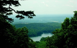
Situated along the peaceful shore of the 100-acre Lake Russell, this developed recreation area offers 42 campsites that accommodate both tent and RV camping and a picnic shelter with seating for 30 is available on a first come first serve basis. Hiking trails are available year-round and a 4.6 mile loop goes around the shore of this beautiful 100-acre lake. The Ladyslipper Trail is a nice 6.2 mile hike that loops through the forest behind Nancytown Lake. The Sourwood Trail is a 2.7 mile loop trail which features “Nancytown Waterfalls” at the 1.5 mile mark. The Facility has a large grass-covered beach, swimming area, two paved campground loop roads for easy access, plus camping, swimming, picnicking, hiking, biking, fishing, horseback riding, and boating (non-motorized/electric watercraft only), this ideal getaway is sure to become an outdoor destination for the entire family! From Cornelia, take Hwy. 13 or Dicks Hill Parkway onto the paved Lake Russell Road, where you will see the entrance. Nearby Cornelia, GA sites include: The Chenocetah Fire Tower is the last rock-constructed, working fire lookout tower in the east. Built by the WPA (Works Progress Administration) in 1936 for the Chattahoochee National Forest, the stone tower is 40 feet high and is listed on the National Register of Historic Places. The tower is open to visitors one day a year during the “Big Red Apple Festival.” The city of Cornelia provides hayrides to the tower during daylight hours. Guests may climb to the top for the tower for a spectacular panoramic view of horizons. Downtown Cornelia Train Depot as the original terminal was damaged in a fire, and rebuilt in 1914 to it’s current appearance. Inside the terminal is a museum of early railroad memorabilia, model of the Tallulah Falls train, and two restored cabooses by the depot. The “Big Red Apple,” stands near the train depot as a monument that is seven feet tall, 22 ft. in circumference and weighs 5200 lbs. It was shipped from Virginia in 1926 to celebrate the apple industry. The Community House on Wyly Street is a handsome stone & log structure built by the CCC in 1936 and listed on the National Register. Hilliard Wilbanks memorial and the adjoining park that features picnic areas, playground equipment and walking trails. Loudermilk Boarding House on Foreacre St. Built in 1908 and listed on The National Register of Historic Places features Joni Mabe’s Panoramic Encyclopedia of Everything Elvis Habersham County Historical Society and Telephone Museum is on North Main Street. The building houses an extensive collection of telephone equipment, area information, historical maps, and a telephone receiver that was patented by Alexander Graham Bell in 1876. Stroll through downtown Cornelia with shops and restaurants that uphold the small town atmosphere that takes pride in the community by preserving history and natural resources. For more information on Habersham County, visit www.habershamchamber.com.

Lake Russell Recreation Area2023-10-27T13:30:13-04:00

North Georgia Hiking Trails

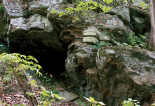
Many visitors come to explore the hundreds of trails through North Georgia’s National Forest.  Whether you want to see a waterfall, like to go hiking, biking, or horseback riding, here are some suggestions for a trail adventure: Ellijay - Three Forks Trail: To the left (North) on the trail is Long Creek Falls (2.3 miles round trip) . To the right is a beautiful section of old growth forest along Stover Creek. Directions: Take 52 East from Ellijay about 4.8 miles. Turn left on Big Creek Road at the Dollar General. Follow this road about 15.4 miles (the final .4 miles are dirt) to Forest Service 58 and turn Right. This road follows Noontootla Creek to Three Forks. Parking is available where the trails cross the road. Blue Ridge - Free Knob Loop Trail: 2.5 miles, easy rating Directions from Blue Ridge, Georgia: Travel east (toward Blairsville, GA) on GA Hwy 515, approx. 0.8 miles past intersection with GA Hwy 5. Turn Right at Windy Ridge Rd., go 0.2 miles to dead end with Old U.S. 76. Turn left, go 0.2 miles to Aska Road on right. Continue south on Aska Read to Shallowford Bridge. Turn left across river and immediate right on dirt-gravel road leading to Dial, GA. At 0.4 miles come to point where trail enters road from forest. Continue east on road to parking area at 1.2 miles. Suches - Jarrard Gap Trail Trail: 1.0 mile, easy/moderate rating Directions: Take US 19 and 129 south from Blairsville Georgia for 9.5 miles. Turn right (west) onto GA 180 and go 7 miles to the main entrance to Lake Winfield Scott Campground. Turn left into the campground. Follow this road over a hill and continue straight ahead into a gravel parking lot at the foot of the hill. From the parking lot, hike along the paved road passing the guard rail at the head of the lake. The trailhead is on the right of the road just past the guard rails. Blairsville - Sosebee Cover Trail Trail: Traveling through a second-growth cove hardwood forest, the 0.25 mile Sosebee Cove Trail is rated easy and receives moderate use. This area is a memorial to Arthur Woody, who served as the first Forest Service Ranger in Georgia. Directions: from Blairsville Georgia, travel 9.5 miles south along US 19/129 and turn right (west) onto GA 180. Continue along GA 180 for 2 miles to the Sosebee Cove parking lot on the right. Hiawassee - High Shoals Creek Trail: The two waterfalls on High Shoals Creek are the highlight of this 170 acre site. A 1.2 mile trail takes visitors from FS 283 down to the falls. Directions: Take 75 South from Hiawassee turn right onto Indian Grave Gap Road, graveled Forest Service Road 283 which leads visitors through the Swallow Creek Wildlife Management Area to the High Shoals Creek Falls Scenic Area. Dahlonega - Yahoola Creek Trail: This is about a 4 mile trail that circles Yahoola Creek Reservoir but also swerves [...]

North Georgia Hiking Trails2023-10-27T13:30:13-04:00

Biking in the North Georgia Mountains

Mountain cycling in North Georgia offers the best views overlooking lakes, lush forests, streams, and rivers, in pristine State Parks/Wildlife Management areas. Starting from rolling hills to steep mountain grades many trail rides offer a variety of degrees from the novice to experienced to go through the backcountry of these beautiful mountains. It is highly recommended that all levels of skill be prepared for your trail ride.  Complete information about the trail, which includes distance, terrain, weather conditions, plus good equipment and supplies for your excursion, will help to make the trip enjoyable. Organizations such as IMBA, SORBA, SABA, NGCA, and NGBDA can tell you specifics about trails, races, and other group ride events. Visit a local bicycle shop, listed in our area directory for further information. Websites we like include www.trails.com and www.dirtworld.com Listed below are just a few of the numerous biking trails over a broad range of North Georgia”™s eight counties to explore. Happy Trails! Ladyslipper - Cornelia - 7.2 miles Jasus Creek Loop - Helen - 12 miles Tallulah Gorge State Park - Shortline Rail Trail  - 2.4 miles Tallulah Gorge State Park - Tallulah Gorge Trail  - 20 miles White Twister - Clayton - 4 miles Cooper Creek - Blairsville - 12.4 miles Davenport Mountain - Blairsville - 5 miles Sosbee Cove Suches - 7.8 - miles Duncan Ridge - Suches - 20.5 miles Flat Creek Loop - Blue Ridge - 6 miles Hickey Knob - Blue Ridge - 4.6 miles Long Branch Loop - Blue Ridge - 2.3 miles Bear Creek - Ellijay - 8 miles Mountaintown Creek - Ellijay - 19 miles Ridgeway Bike Trail - Ellijay - 5.6 miles Rich Mtn Wildlife Mgmnt Area - Ellijay - 6 miles Bull Mtn / Moss Creek - Dahlonega - 11.3 miles Montgomery Creek Loop - Dahlonega - 8.5 miles Turner Creek Loop - Dahlonega - 4.4 miles

Biking in the North Georgia Mountains2023-10-27T13:30:13-04:00
Go to Top