Our guide to Blairsville, GA. Restaurants, events, places to stay and things to do.

Biking in the North Georgia Mountains
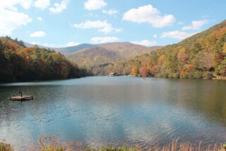
Mountain cycling in North Georgia offers the best views overlooking lakes, lush forests, streams, and rivers, in pristine State Parks/Wildlife Management areas. Starting from rolling hills to steep mountain grades many trail rides offer a variety of degrees from the novice to experienced to go through the backcountry of these beautiful mountains. It is highly recommended that all levels of skill be prepared for your trail ride. Complete information about the trail, which includes distance, terrain, weather conditions, plus good equipment and supplies for your excursion, will help to make the trip enjoyable. Organizations such as IMBA, SORBA, SABA, NGCA, and NGBDA can tell you specifics about trails, races, and other group ride events. Visit a local bicycle shop, listed in our area directory for further information. Websites we like include www.trails.com and www.dirtworld.com Listed below are just a few of the numerous biking trails over a broad range of North Georgia”™s eight counties to explore. Happy Trails! Ladyslipper - Cornelia - 7.2 miles Jasus Creek Loop - Helen - 12 miles Tallulah Gorge State Park - Shortline Rail Trail - 2.4 miles Tallulah Gorge State Park - Tallulah Gorge Trail - 20 miles White Twister - Clayton - 4 miles Cooper Creek - Blairsville - 12.4 miles Davenport Mountain - Blairsville - 5 miles Sosbee Cove Suches - 7.8 - miles Duncan Ridge - Suches - 20.5 miles Flat Creek Loop - Blue Ridge - 6 miles Hickey Knob - Blue Ridge - 4.6 miles Long Branch Loop - Blue Ridge - 2.3 miles Bear Creek - Ellijay - 8 miles Mountaintown Creek - Ellijay - 19 miles Ridgeway Bike Trail - Ellijay - 5.6 miles Rich Mtn Wildlife Mgmnt Area - Ellijay - 6 miles Bull Mtn / Moss Creek - Dahlonega - 11.3 miles Montgomery Creek Loop - Dahlonega - 8.5 miles Turner Creek Loop - Dahlonega - 4.4 miles