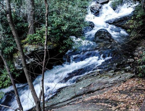
Big Laurel and Mooney Falls
Standing Indian area – one roadside, the other a fairly easy to maybe moderate hike
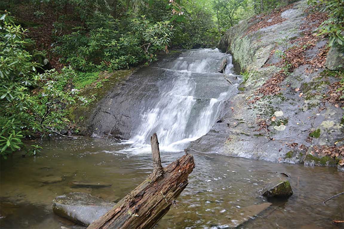
Directions: From the turn off to Rufus Morgan Falls, continue west on Hwy 64 for 6.3 miles and turn left on west Old Murphy Rd. Look for a brown and white sign for Standing Indian Campground. This turn is about 12 miles from the intersection of 64 west and 441/23 just outside of Franklin. Drive just under 2 miles and turn right at the sign for Standing Indian Campground (FR67). Drive 6.7 miles down FR67 – bearing left at the entrance to the campground – to a pull out on the right at the trail head for Big Laurel Falls. The road turns from pavement to gravel and the last couple of miles are rather rocky. You can do it in a passenger car, just drive slower. The hike is an easy 1/2 mile along Big Laurel Branch, mostly through rhododrendron. A short distance from the trail head, turn right at the ‘T’ intersection and cross the bridge. Turn right again after crossing and follow the trail up the creeks to the waterfall. The waterfall is only 20’ or so, but it’s in a secluded setting and there’s a nice little swimming hole at the base. If you’re lucky, you’ll have the place to yourself.
About 1/4 mile farther up FR67 on the right is the trail head for Mooney Falls. The trail is short, switchbacking down the bank to the base of the lower drop. At the 2nd switchback, the trail to the left leads to the upper cascades. Climb up on the big rock for this nice view.
Bridal Veil Falls
2.5 miles west of Highlands on Hwy 64. Watch for the brown and white forest service sign on the right hand side of the road. You can use the road side pull off to actually drive under this waterfall!
Cullasaja Falls
5.5 miles past Dry Falls heading west on Hwy 64, is Cullasaja Falls. This road side area is small with a lot of passing traffic, so be cautious and pull off the road completely. There is a very steep trail that leads to the bottom of the falls, but in heavy flow conditions, the trail can be wet and slippery. Again, please use caution.
Dry Falls
Continuing west on Hwy 64, just past the intersection with Hwy 106, look for the brown and white forest service sign for Dry Falls and turn left into the parking area. There is a wheelchair accessible viewing area for an easy viewing as well as stairs and a short trail down to the waterfall for a close up look and the ability to walk behind the falls. This waterfall is stunning and the photo opportunities are plentiful.
Fires Creek Falls, AKA Leatherwood Falls
From Hayesville, Hwy. 64 take Fires Creek Rd. to Fires Creek Wildlife Road. Follow road along Hiwassee River until you see the signs. This area has plenty of hiking trails, including a 25-mile Rim Trail. Fires Creek Falls is an absolutely beautiful waterfall with a sizable drop. It’s a must-see for waterfall enthusiasts.
Rufus Morgan Falls
Moderate hike in the Franklin area
Directions are as follows: Get on Hwy 64 west from the intersection of 64/28/441/23 in Franklin for about 4 miles and turn right on Old Murphy Rd. Then turn left on SR1310 – Wayah Rd – less than 1/4 mile down. It’s just past the gas station. After 6.3 miles on Wayah Rd, turn left on the gravel FR388 and follow it up for 2 miles to the obvious parking area on the right.
The trail is about a mile round trip, easy to follow, and easy to moderate in difficulty. As you get closer to the falls, the trail bisects a huge landslide area that possibly came down with heavy rains. The trail crosses Rough Fork at the base of a small falls and from here you can see Rufus Morgan Falls upstream. Soon after crossing here, the trail splits. Straight ahead is the other part of the loop. Take the right trail up to the base of the 60’ Rufus Morgan Falls, which is a very secluded setting.