Road Trip To: Vogel State Park
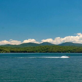
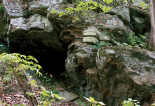
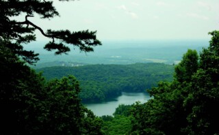
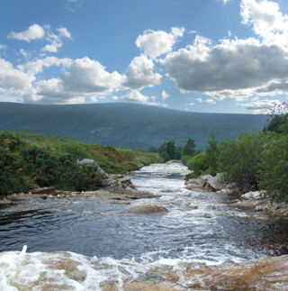
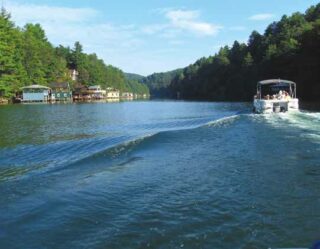
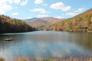
Nestled in the heart of the Chattahoochee National Forest, Vogel State Park is one of Georgia’s favorite destinations. Established in 1931, Vogel, is the second oldest state park in Georgia and rises 2,500 feet above sea level. The entire area around Vogel was once linked to the Native Americans and the State Park sits at the base of Blood Mountain, the highest summit on the Appalachian Trail in Georgia. Driving from the south, visitors pass through Neel Gap, a beautiful mountain pass near Brasstown Bald, which is the highest point in Georgia. The history of the “Vogel” name starts in the 20th century when Augustus Vogel and Fred Vogel Jr. began a lumber mill in Union County. The mill employed many of the men in the county to cut and process lumber from the 65,000 acres of land owned by the Pfister Vogel Leather Company. Unfortunately, the state of Georgia entered an economic downturn in the mid-1920’s and the lumber mill was no longer economically feasible. In 1929 the Vogels donated nearly 259 acres to the state, much of it still encompassed within the 233-acres within Vogel State Park. This park shares a timeless connection with its Civilian Conservation Corps builders that dammed Wolf Creek to form Lake Trahlyta and built housing around the lake for the CCC boys. The 22-acre Lake Trahlyta is named for the Cherokee maiden whose grave sits at the center of Stonepile Gap. The rest of the land donated by the Vogels is under the Chattahoochee National Forest and includes the stone building now known as Mountain Crossings at Walasi-yi and Nottla or Nottely Falls, east of the Byron Herbert Reese Trail parking lot. Originally, Walasi-yi was a restaurant run by the state. Directly by Vogel is the Byron Herbert Reece Farm and Heritage Center that celebrates the life of this famous poet who received numerous awards for his writing. The center has wonderful displays, restoration of the Reece writing studio, authentic farm buildings and equipment, plus self-guided tours. Vogel State Park offers a variety of hiking, swimming, fishing and enjoying family time in a diverse mountain landscape. An easy 1.0 mile hiking trail circles the lake, allowing access to fishing docks and the boathouse. A 0.1 miles side trail takes hikers down to Trahlyta Falls, also know as Spillway Falls. A spur trail off the Trahlyta Lake Loop will take you down to an observation deck at the bottom of the roaring falls! More experienced hikers may enjoy the popular 4-mile Bear Hair Gap and the challenging 13-mile Coosa Backcountry Trail. Helton Creek Falls can be found just minutes away from Vogel. There are two waterfalls to see — the lower and upper falls — and the hike is a short, family-friendly 0.6 miles. If you’re looking for another nearby waterfall hike for the whole family, look no further than DeSoto Falls! The DeSoto Falls hike also takes you to two waterfalls, and has a beautiful picnic area. Cottages, campsites and primitive backpacking [...]